
")

Since our inception, we have been at the forefront of transforming geological sciences through the power of Artificial Intelligence (AI), Machine Learning (ML), and more. Specializing in the digitalization of geological data, Fosidso offers Geostudy, our advanced suite of tools including Fosidso, Sedidso, Stratidso, and Strucso, designed to enhance the accuracy and efficiency of geological studies by providing comprehensive tools for fossil identification, sedimentary environment analysis, stratigraphic correlation, and structural assessment, thereby supporting a range of geological projects from oil and gas exploration to ecological and renewable energy studies.
Our key services integrate seamlessly into geological workflows to optimize exploration and development through intelligent, data-driven insights:
• Automated Data Analysis: Rapid and standardized processing of geological Big Data to aid in predictive modeling and integration.
• Enhanced Decision Making: Real-time geological monitoring combined with advanced analytics to refine exploration targets and geological models.
• Innovative Geological Mapping: Utilizing AI to generate and update geological maps, tectonic models, and identify potential natural ressource deposits dynamically.
Key Benefits:
• Streamlined Operations: Our services integrate and optimize geological data from various sources, significantly speeding up the exploration process.
• Informed Exploration: We equip geologists and mining companies with the tools to identify promising areas, optimize drilling operations, and predict mineral distributions with higher accuracy.
• Risk Management: Fosidso reduces geological and operational risks through sophisticated analysis and real-time data monitoring.
Looking ahead, our roadmap includes PTASO (Petroleum Geology Analysis Software) and GeoChemidso for advanced geochemical data interpretation. These tools are part of our ongoing commitment to redefine the landscape of geological exploration with cutting-edge technology. Join us in unlocking the planet's hidden value as we streamline operations, empower professionals with informed exploration capabilities, and innovate geological mapping with AI.
Experience the future of geological exploration with Fosidso, where cutting-edge technology meets terrain.


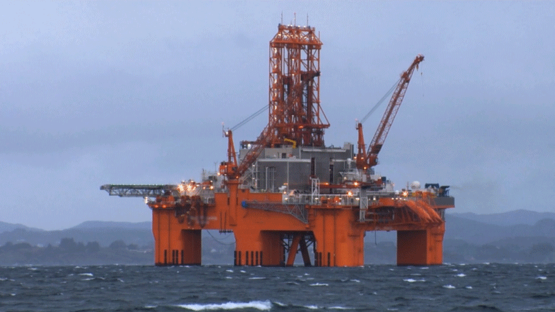
We offer a comprehensive suite of services, including fossil identification, biozonation, log interpretation, sedimentary rock analysis, biozonation, paleolog and correlation, to optimize exploration and well placement in the oil and gas industry. The gaz and oil industry relies heavily on microfossils such as foraminifera to find potential hydrocarbon deposits.
Palaeontology and stratigraphic studies also play a significant role in geological surveys, such as in the preparation of geological maps.

Site investigations and seismic hazard assessments also benefit from palaeontology and stratigraphic studies in which age determination of rock units, distinguishing engineering property changes associated with unconformities, faults, and facies changes occur.
Palaeoseismology is the study of the so-called ‘ground effects’ of past earthquakes, which include vertical fault movements and tsunamis.

Geochemistry, palaeontology and stratigraphy are reliable tools that are used by oceanographists to monitor oceanic streams, chemical composition and other changes that have occurred during the earth’s history and correlate them with contemporary changes.
Palaeoecology and palaeoclimatology accurately lead us to interpret global warming and glacial period ecosystems through the data that remains from fossils and deposits.

Different Fossil Groups, Sedimentary Lithology,
Texture & Facies. Diagenesis
Geological Rock Typing
Unconformity
As an Out-of-Lab Service

Determining the Relative Age,
Stratigraphic Chart
(Bio, Litho, Sequence)
Paleolog, Sedlog
Correlation 2, 3D
GIS capabilities usage
Well Logging (Lithology)
Porosity & Permeability
Depth Matching
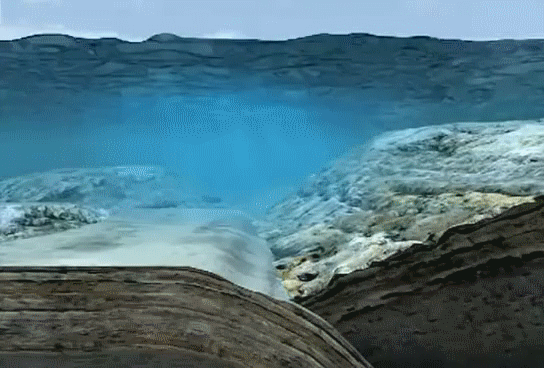
Depositional Environment


We can increase the accuracy and reliability rate from 60% to 95%, taking into consideration various possibilities in fossil identification, including visual and verbal help, as well as creative procedures.


We offer a comprehensive suite of services including precise and efficient field exploration for predicting and discovering natural resources, optimizing well placement, revising and standardizing geological data, and managing data through customized platforms. Our services ensure cost-effective operations, actionable insights from existing data, and long-term decision-making support through comprehensive training and platform maintenance. These services are powered by our Geostudy software, a versatile tool built on a unique database for stratigraphic, paleontologic, and geological studies, featuring six specialized modules: Fosidso, Sedidso, Stradidso, Strucso, Petalso, and Geochemidso.

The identification of different fossil groups,
including both isolated and thin sections.

FOSIDSO determines events, biozones referring to interpretations and processes of the lithostratigraphy column data and the content of the taxa.

We analyze sedimentary rocks to deliver essential insights for reservoir characterization and exploration. Our services include detailed identification of textures, structures, porosity, rock types, sedimentary facies, diagenetic facies, sedimentary sequences, and more.

Paleontology and stratigraphy determines the expansion of layers to develop oil exploration, as well as the actual depth and thickness of reservoirs. To determine the best path to reach the others reservoir, correlation is necessary

By marking lithological features with different logs and merging them with cutting stratigraphic columns, we are able to compile an accurate log interpretation, which is a prominent goal in FOSIDSO.

Utilizing our advanced software, we optimize well placement and exploration strategies through precise geological data analysis, enabling more efficient and cost-effective exploration and drilling operations.

In addition to possessing an enriched database of biozones and various fossil groups, FOSIDSO is able to localise data and customise the database to meet each customer's expectations.

We can help you learn how to identify countless fossil groups, in thin sections or isolated specimens, using both visual and verbal methods.
Our system, Geostudy, integrates a suite of specialized software tools, including Fosidso, Sedidso, Stratidso, and Strucso, to deliver comprehensive geological analysis and data management. Geostudy harnesses the power of Artificial Intelligence (AI), Machine Learning (ML), Deep Learning (DL), and Neural Networks (NN) to transform vast amounts of raw geological data into actionable insights.
Here's how it works:
Data Collection: Geostudy begins by aggregating geological data from various sources, including satellite imagery, field data, and laboratories data.
Data Processing: Utilizing AI, ML and DL algorithms, the system standardizes and processes the collected data to identify patterns, anomalies, and critical geological features.
Analysis and Modeling: The processed data is then analyzed to generate predictive models and dynamic geological maps. These models help in identifying potential mineral deposits, assessing geological risks, and planning exploration strategies.
Decision Support: Geostudy provides geologists and project managers with user-friendly tools and dashboards, offering deep insights and real-time monitoring capabilities. This empowers teams to make informed decisions, optimize exploration targets, and refine geological models effectively.
Continuous Learning: Our system continually learns from new data and user feedback, enhancing its analytical models and improving prediction accuracy over time.
By seamlessly integrating these steps, Geostudy ensures that geological exploration and resource management are not only more efficient but also significantly more precise and cost-effective.
Foraminifera are members of a phylum or class of amoeboid protists.
They typically produce a test or shell, which can have either one or multiple chambers, with some becoming quite elaborate in structure.
The form and composition of the shell are the primary means by which foraminifera are identified and classified.
The shell or test are founds as fossils from as far back as 547 MY ago, and many marine sediments are composed primarily of them.
Because of their diversity, abundance, and complex morphology, foraminifera can accurately determine the relative age of sedimentary rocks.
The oil industry relies heavily on fossils such as foraminifera to find potential hydrocarbon deposits.
Calcareous foraminifera are formed from elements within the ancient seas they lived in. Thus they are very useful in paleoclimatology, paleoceanography and paleogeography.
They also can be used to reconstruct past climates by examining the stable isotope ratios and trace element content of the shells (tests).
Global temperatures and ice volumes can be revealed by the isotopes of oxygen, and the history of the carbon cycle and oceanic productivity can be revealed by examining the stable isotope ratio of carbon.
Fossil records of planktonic foraminifera are also used to reconstruct ancient ocean currents.
Oil companies study microfossils and examine oil-bearing formations and their expansion, both geographically and in terms of modelled and mapped basins, to locate drilling sites and routes, in addition to decreasing risks in exploration and drilling. Impeccable detection of drilling locations requires a determination of the relative ages of the petroleum system elements and the cap rocks, identification of the faults, and determination of the thickness of the formations that contain petroleum. The use of fossils in geological map preparation is undeniable.
Palaeontology and stratigraphy are useful in mineral exploration and exploitation. The major role of fossils is in determining the age of mines and ore deposits. Additionally, some fossils are an index of specific kinds of mineral deposits (like phosphate deposits). Fossils can help us to determine the reason behind various changes in mines and ores.
The major pro in the study of geophysics is the high speed at which results are reached, but there are also some large cons in this regard:
high expenses are incurred, and it is not possible to over-generalise it in all exploration projects, which means that eventually palaeontology and stratigraphy studies must be done to complete and control the study process. The exact boundaries of the layers, layer reversion and repeat layers are determined by palynology studies.


Fosidso GmbH is a Swiss-based organisation that collaborates with international specialists in IT, geology, and palaeontology. We provide a comprehensive suite of integrated services for the oil & gas industry and other industries that make use of microfossil data.